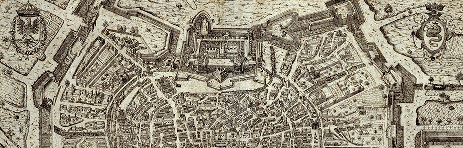
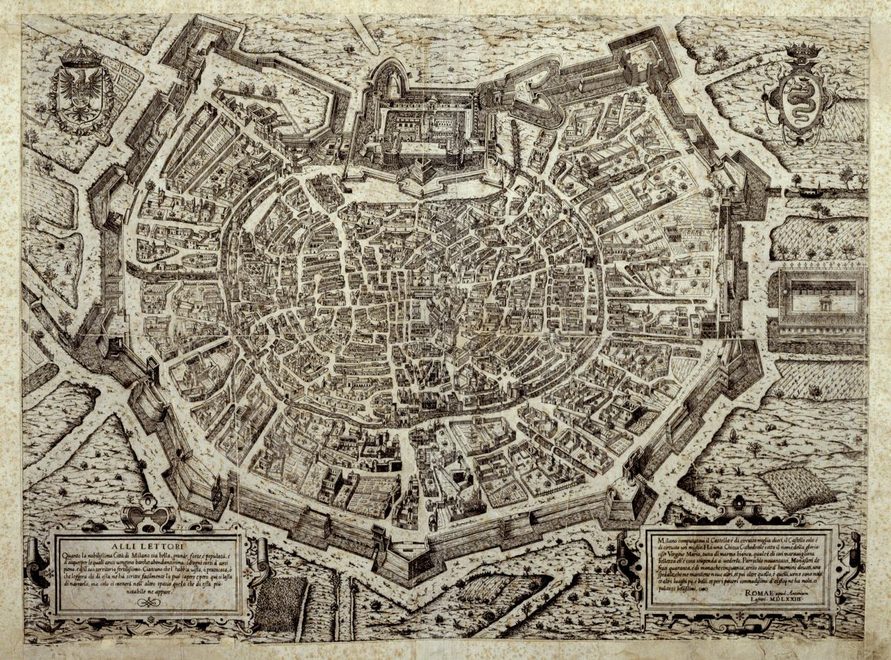
Antonio Lafrery, Pictorial map of Milan
Antonio Lafrery, Pictorial map of Milan, etching, 1573
Although bearing the date 1573, the map, if analysed in relation to the progress of the city's fortifications and the Castle, reflects the topography of Milan in roughly 1560. This is the first engraving to represent the entire city. Unlike urban maps of the 16th century, Lafrery’s has the east to the bottom right corner of the map, so that the Castle is at the top, at the centre of the crown formed by the fortifications. The map is an exceptional document of Milan during Spanish rule, following the works promoted by the governor Ferrante Gonzaga. From the quadrilateral Sforza fortress, two additional fortifications built in 1552, protrude: the Tenaglia (literally, the Pincer) towards the Comasina gate and a more simple fortification towards the Vercellina gate, both demolished after 1560 for the construction of new castle defences.